Local history
Benitatxell did not appear from nowhere, nor did it begin on a single date. Before it was a town with a church, square and town hall, it was an inhabited, worked and named territory, a place where water, terraces and paths already shaped daily life.
Local history can be followed as a continuous thread: first, the long pre-foundation period of the landscape and the alquerías; then the founding of the municipality in 1698; later, the slow transformation of an agricultural town marked by emigration, trades and modernity; and finally, the present day, in which the past still carries weight in the identity of the place.
Before the
foundation
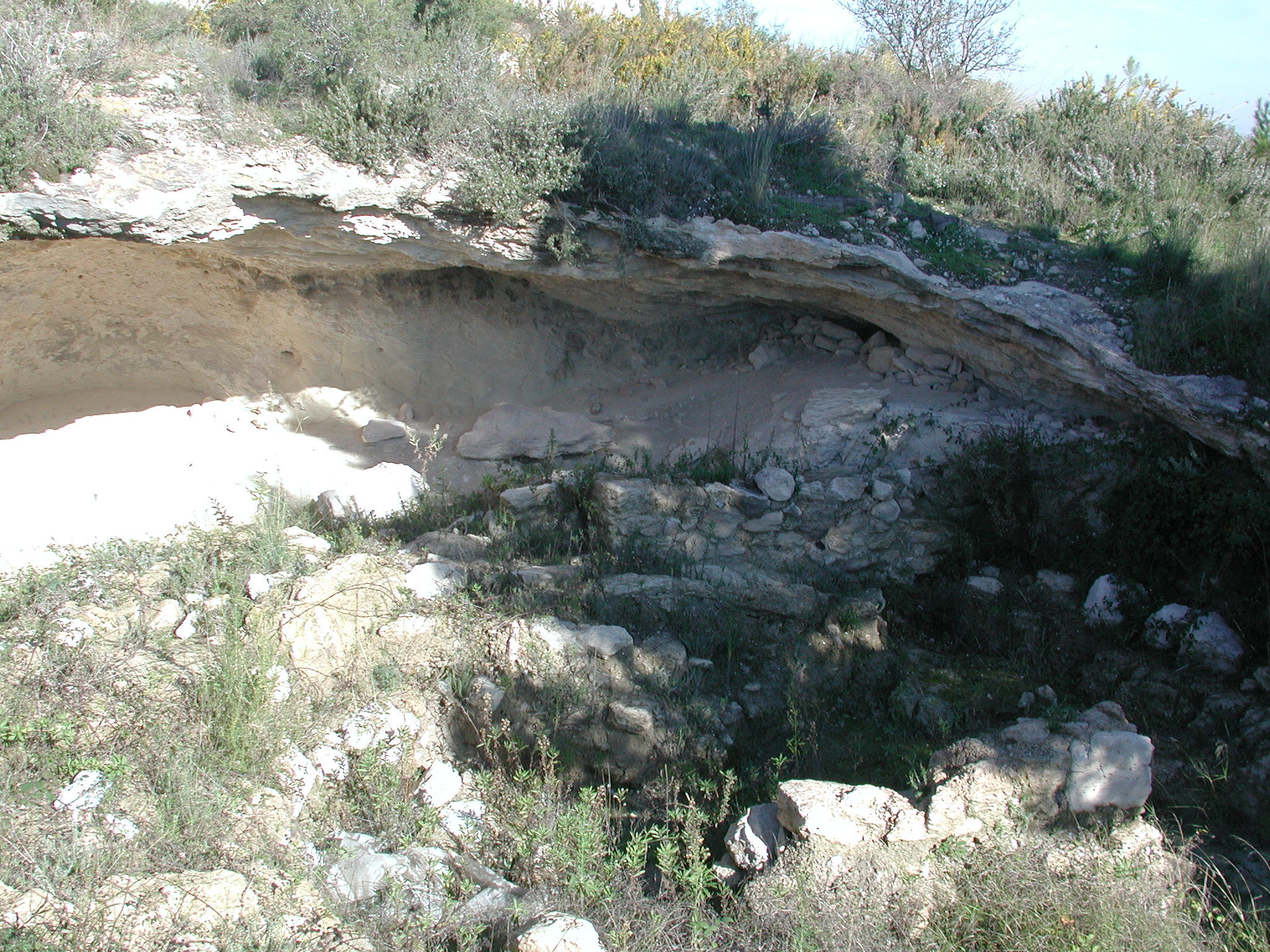
Before the Poble Nou, there was time, land and memory. The first signs of occupation date back to the Palaeolithic, with finds in Cova del Moro that place human presence in the area around 18,000 years ago. Chalcolithic remains have also been documented at the same site and at els Forats del Barranc de l’Asbardal.
Evidence from the Bronze Age remains at Tossal d’Arnau and Tossal Redó, two elevations from which the territory was controlled. Later, in the Iberian period, Tossal de l’Abiar and the finds on the slope of Cova de les Bruixes stand out. The Roman period also left an important trace in l’Abiar, an area favoured by its groundwater and linked to agricultural exploitation and wine production.
The Andalusian presence finally fixed many names and many ways of inhabiting the place. Lluca, Abiar, Alcassar, Moraig and Benicambra are not just place names: they are living remains of a time when the territory was already organised into alquerías, wells, silos and cultivated spaces. Before the town was founded, Benitatxell already had landscape, water and life.
22 houses,
100 inhabitants.
In 1244, with the Christian conquest of Dénia and its territory by Jaume I, the Benitatxell area entered a new political framework. But the decisive change came centuries later. The expulsion of the Moriscos in 1609 left the old Arab alquerías of l’Abiar and Benitagell depopulated, and they were abandoned between 1609 and 1617.
A new stage of repopulation then began with new settlers from Mallorca, the lower Segre basin and Lleida. The process culminated in the official constitution of the universitat or municipality of Benitatxell on 4 January 1698. Until then, the population depended on Xàbia, within the Marquisate of Dénia; from that moment it became its own entity and began to assert itself around the new urban core.
The act of erection of 1698 documents 22 houses and around a hundred inhabitants between the nuclei of l’Abiar and Benitatxell. It also mentions the old village of Lluca, described in the document itself as “Poble antich que al present está derruit anomenat de Lluca”. In contrast with that ruined settlement, the name Poble Nou came to express clearly the birth of a new town.
4 January
1698
The founding of 1698 meant more than an administrative boundary: it was the beginning of a community with its own territory, its own resources and its own way of recognising itself in the landscape.
Recent history
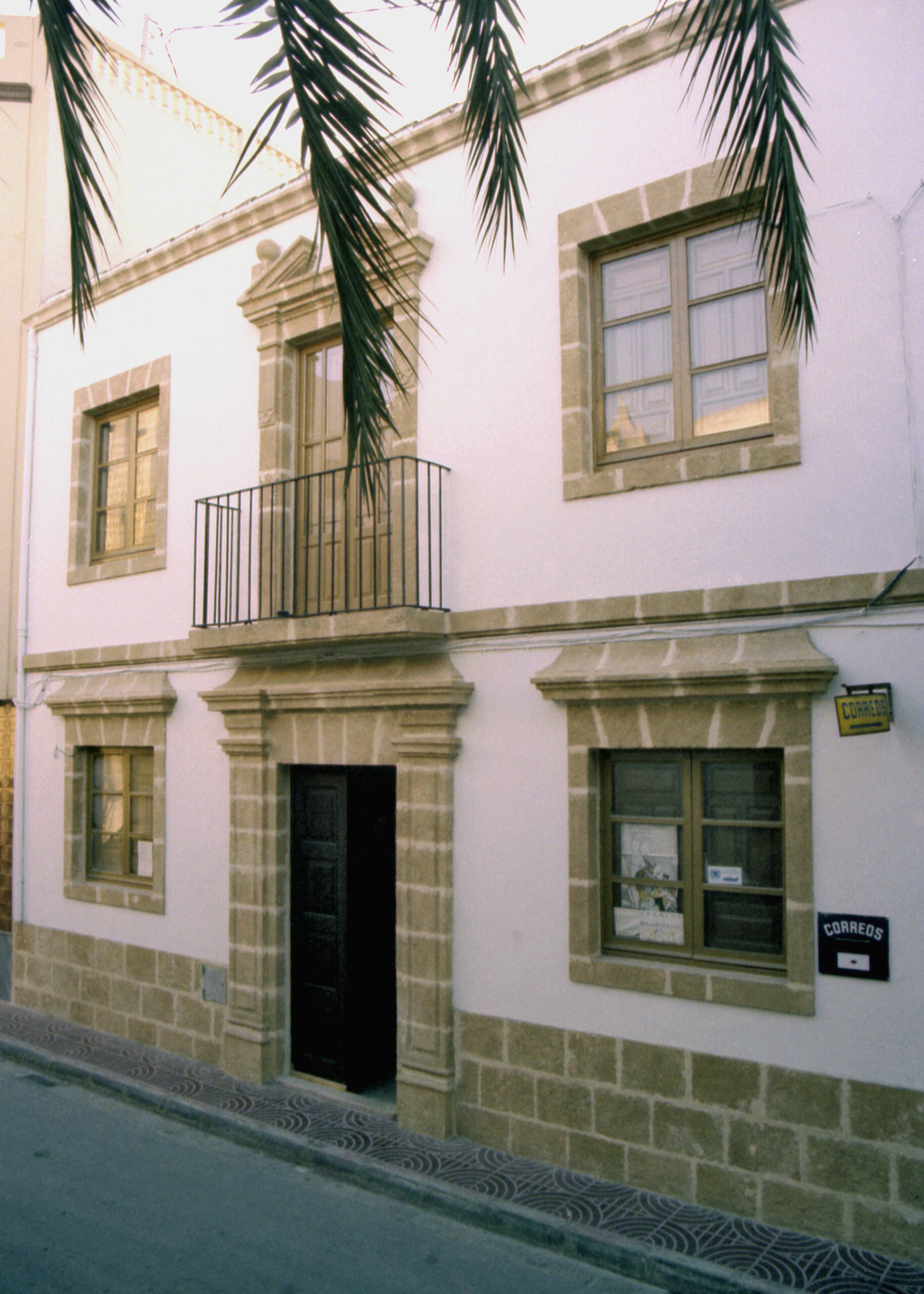
After the foundation, Benitatxell took on the form that can still be read in its historic centre. The church of Santa María Magdalena, whose construction began in 1710, became the main landmark of the new nucleus, while the square, Calle Mayor, the town hall, the oven, the butcher’s shop and the inn organised the daily rhythm of the town. Ecclesiastical independence from Xàbia would come later, in 1768, reinforcing the municipality’s autonomy also in religious terms.
During the 19th and 20th centuries, the municipality continued to change while remaining an agricultural town. Vines, raisins and muscatel sustained much of the economy, and around that world the most common trades can be recognised: farmers, vine pruners, workers in the escaldà and raisin production, small market traders and trades linked to everyday supply, such as the oven or the butcher’s shop. Craft work such as wickerwork, used in the making of hats, baskets and other everyday objects, was added to this agricultural continuity.
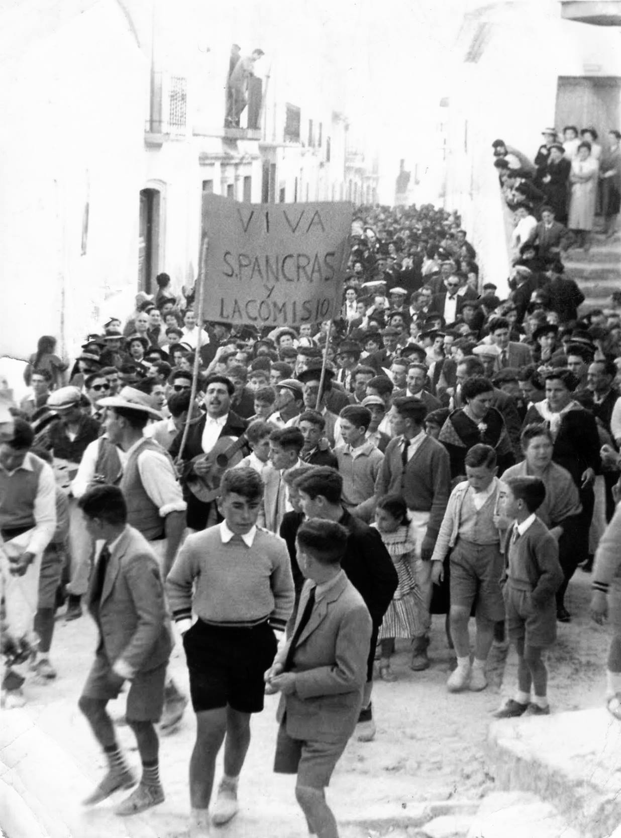
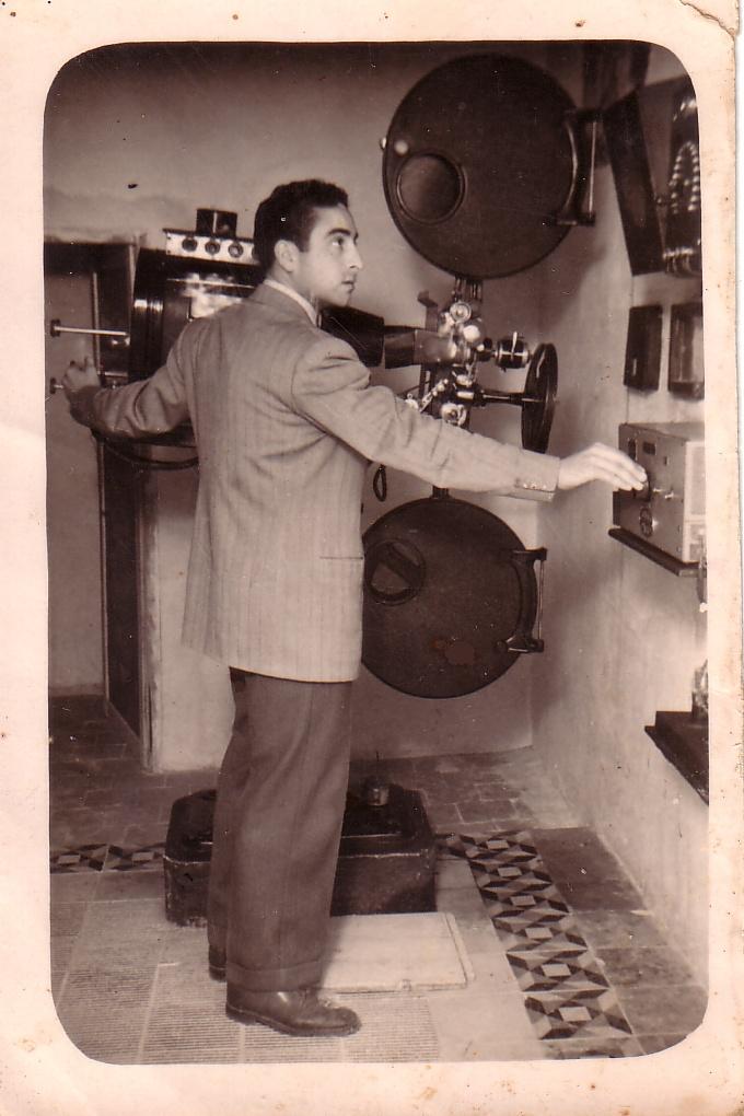
Other ways out were added to that work on the land. Emigration to Argentina and Oran opened new sources of income for many families, and on the coast the pesqueres de cingle represented a hard, nocturnal and risky economy, linked to the cliffs and to the times when the vine no longer provided work. Later, the arrival of electricity in 1909, the activity of the Anti-Caciquist League, the cinema, markets and other spaces of sociability show a town attentive to the changes of its time while remaining itself. Even the church, one of its great visual landmarks, carries that history: its blue glazed dome was split by lightning in 1940 and decades later was restored again as a landmark of the regional landscape.
An open-air
museum
Today, Benitatxell looks at its history not as a relic, but as a living part of its identity. The recovery of heritage, the digitisation of the parish archive and the municipal archive, and projects such as Museu al Vent allow that memory to be more visible and more widely shared today.
The municipality cannot be understood only through its coast or its immediate landscape. It is also understood through its muscatel terraces, dry stone, agricultural paths and heritage as singular as the pesqueres de cingle, which precisely sum up the harshness of work, the relationship with the sea and the town’s capacity to turn necessity into a way of life. Much of today’s Benitatxell can be recognised at that crossroads between memory, landscape and local continuity.
Benitatxell ve de lluny
This short film is part of Venim de Lluny, a documentary series by Col·lectiu Mirades dedicated to recovering the historical memory of the Marina Alta, town by town. In the chapter dedicated to El Poble Nou de Benitatxell, local history is traced from its origins to more recent memory through expert voices, testimonies and visual archive material.